
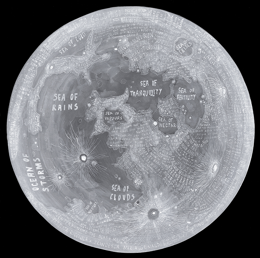
Moon Map
An annotated map of the moon documenting layers of lunar knowledge from the earliest drawings in caves to Gallileo’s telescope to traditional folklore and the moon landings. I am interested in how maps can explore layers of history and knowledge; a cultural geography and not just a physical geography.
This map is drawn in white ink on slate coloured board and is framed in black wood, float mounted on black with a further circular window mount.
Unframed giclee prints 40×40 cms here.
Limited edition print (of 50) 70x70cms available from Art Republic.
Related projects
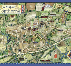
A Map of Copthorne
A map of the Sussex Weald village, Copthorne, commissioned as part of a walking and arts project, ‘About the Place’, by Mid Sussex

A Map of Crawley Down
A map of the Sussex Weald village, Crawley Down, commissioned as part of a walking and arts project, ‘About the Place’, by Mid Sussex
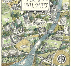
A Map of Civil Society
A map commissioned by Rethinking Civil Society, an academic project based at the University of York in collaboration with the Leverhulme Trust
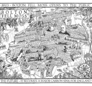
A Map of Bolton Fell Moss
A nine month project in collaboration with the University of Cumbria as an Honorary Research Fellow, National England and the PLACE collective.
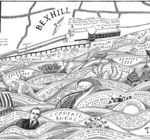
Mural: A Map of the Sea and the De La Warr Pavilion
A commission by the De La Warr Pavilion on the UK South Coast to create a mural of a map reflecting the Pavilion’s relationship with the
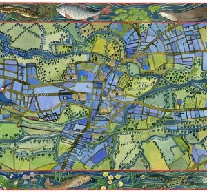
A Map of the Waterways of Oxford
An illustrated map of the waterways of Oxford showing the historic features of the city with borders of local river wildlife. Watercolour,

The Apple World
A map of the history, science and culture of the apple throughout the world, commissioned by the National Trust, the Museum of Cider and the
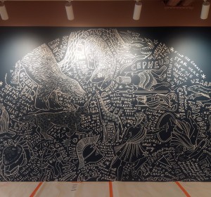
Mural: A Map of the Midsummer Stars above Brighton
I was commissioned to adapt my original ‘Map of the Winter Stars from the Northern Hemisphere’ into a mural by MMoser Associates. The

A Map of Gyptian Waterways in Oxford
I was commissioned by Badwolf to create this map prop of the waterways of Oxford for the BBC/HBO production of ‘His Dark Materials’ .
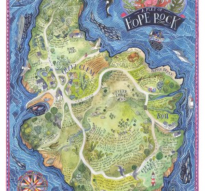
A Map of Hope Rock
I was commissioned to create this imagined island for Thames and Hudson’s ‘Archipelago; An Atlas of Imagined Islands’, edited